One country, one trail
Experience Liechtenstein’s history through the hiking map
04.03.2021
One country, one trail
Experience Liechtenstein’s history through the hiking map
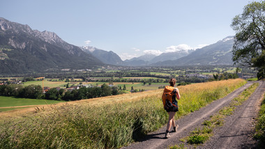
Discover the highlights of the Principality of Liechtenstein on foot or by bike on the Liechtenstein Trail, experience the history of the smallest monarchy in the Alpine region and explore an unspoilt natural paradise in all four seasons: the Liechtenstein Trail is the key to this.
The Liechtenstein Trail connects all the country’s municipalities and invites you to embark on an exciting journey through the Principality. Along the way, you not only discover the history of the country but also experience it virtually: the LIstory app links 147 selected historical sites and events – called experience stations – along the hiking trail to create a living history experience. Since the highest point of the long-distance hike is 1,100 metres above sea level, the tour is also perfect as a leisurely, sporty autumn or winter experience.
Princely long-distance hike with luggage service
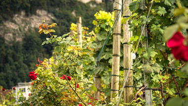
The Liechtenstein Trail leads over the existing network of hiking trails through fields and forests, past traditional village centres and wonderful vantage points – far away from mass tourism. The stages can be chosen individually and combined. You can walk from the south to the north of the Principality or vice versa in just a few days – or a week at most. Hikers can create their own tours according to their own needs and, if required, also book hotel packages and a luggage service. Luggage is transported from one stay to the next on request and, with the Adventure Pass, which is included in the booked package, all public transport in the country is free of charge. Hiking could not be any more comfortable: a princely experience in an enchanting Alpine paradise. Those who prefer to travel a little faster on two wheels can also discover the trail on a slightly modified route by bike.
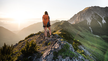
High up on Route 66
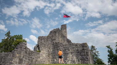
Those who like to go a little higher should not miss Route 66 in Liechtenstein. When you hear the phrase Route 66, you certainly don’t think of mountains at first. But it really does exist: an officially signposted Route 66 is a hiking trail through the entire country. The first stage starts in Malbun. Via the Princess Gina trail, the route goes up to the Augstenberg at 2,359 metres above sea level. It then descends to the Pfälzerhütte, which is a good spot for your first rest. Two classics await on the second stage. From Steg, continue along a ridge path to the Fürstensteig. For hikers who are not afraid of heights and are sure-footed, the Fürstensteig is a unique experience. The path carved into the rock is one of the most famous paths in the Rätikon mountains. After the imposing Fürstensteig, the legendary Drei Schwestern (Three Sisters) mountain range awaits. The Kuhgrat is the highest point of this varied stage, which offers an excellent view of the Rätikon, the Swiss and Vorarlberg mountains. This stage ends at the Gafadura hut. At the end, nature lovers can look forward to a culinary hike. From the mountains, head down to the valley floor. Passing Nendeln and Mauren, you pay your respects to Schellenberg.
Liechtenstein Trail
- The trail leads through all 11 municipalities of Liechtenstein
- Route length is 75 kilometres
- Divided into 12 route sections
- Luggage transport available
- Stages also possible by bike
- LIstory app available in the App Store and on Google Play
- www.liechtensteinweg.li
Route 66
- Three daily stages
- Route length is 49.6 kilometres
- Ascent 2,264 metres in altitude
- Total hiking time 17 hours
- www.tourismus.li/route66
Contact
Liechtenstein MarketingNicole Thöny
Mediensprecherin
Äulestrasse 30
Postfach 139
LI-9490 Vaduz