


Heiligenberg Panorama route (large loop 13.6 km)
Description
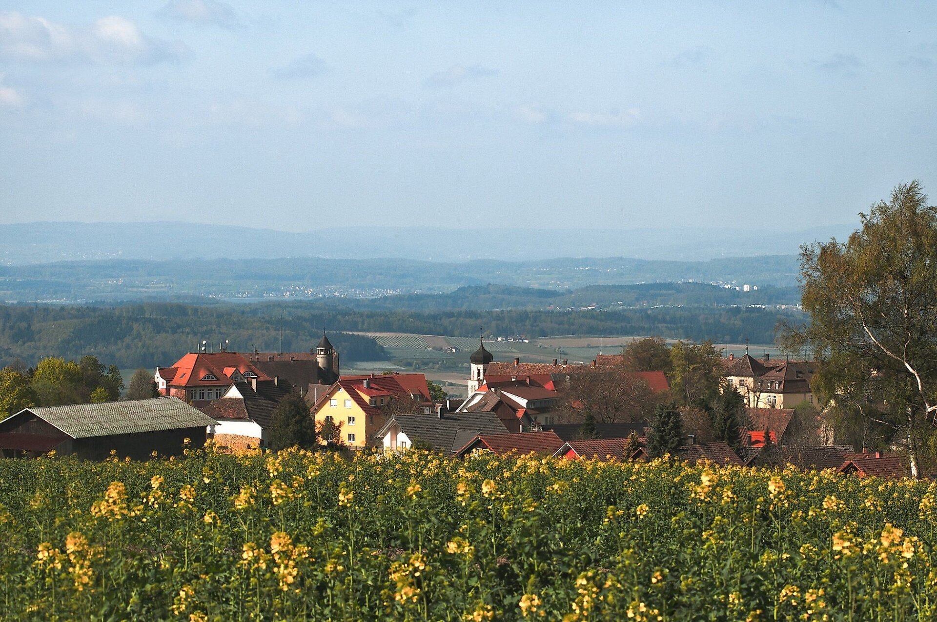
This hiking route connects idyllic paths through the charming highland landscape of Heiligenberg with attractive views of Lake Constance, the Linzgau, the Hegau, over the Black Forest up to the Feldberg. And with really great long-distance visibility, the hiker is presented with the Alpine range from the Allgäu Alps far into the Swiss mountains.
Note: The Panorama route is also available as a smaller loop (6.4 km)
Abstract
This hiking route connects idyllic paths through the charming highland landscape of Heiligenberg with attractive views of Lake Constance, the Linzgau, the Hegau, over the Black Forest up to the Feldberg. And with really great long-distance visibility, the hiker is presented with the Alpine range from the Allgäu Alps far into the Swiss mountains.
Note: The Panorama route is also available as a smaller loop (6.4 km)
Description
Der Heiligenberger Panoramaweg – Große Runde führt auf abwechslungsreichen Wegen durch die reizvolle Höhenlandschaft rund um Heiligenberg. Die Wanderung beginnt am Parkplatz beim Rathaus und verläuft zunächst über den Bellevueplatz und den Karl-Echo-Platz zur Amalienhöhe. Von dort bietet sich ein beeindruckender Blick auf Heiligenberg, den Bodenseeraum und die Hegauvulkane.
Auf der großen Runde geht es anschließend weiter in Richtung Betenbrunn. Über Wiesenwege und durch Wald führt die Strecke zum höchsten Punkt der Gemeinde Heiligenberg. Bei guter Fernsicht reicht der Blick über den Bodensee bis zur Alpenkette. In Betenbrunn laden die Wallfahrtskirche St. Maria und der historische Ortskern zu einem besonderen Zwischenstopp ein.
Der weitere Weg führt durch den Mischwald zur Klause Egg und über das Schweizerhaus zurück nach Heiligenberg. Unterwegs wechseln sich offene Landschaften, Waldabschnitte und aussichtsreiche Wegpassagen ab. Mehrere Rastmöglichkeiten laden dazu ein, die Landschaft in Ruhe zu genießen.
Die Große Runde ist rund 13,6 Kilometer lang und als mittelschwere Wanderung ausgewiesen. Festes Schuhwerk wird empfohlen. Bei klarer Sicht ist die Tour besonders lohnenswert.
Hinweis: Den Panoramaweg gibt es auch als kleinere Runde (6,4 km)
Tip
Combine the hike with a visit to the Pilgrimage Church of St. Maria in Betenbrunn.
Directions
We start from the parking lot on Betenbrunner Straße and first walk past the community center “Sennhof am Schloss” to Postplatz in the town center. From there, continue along Salemer Straße toward the town entrance up to the junction of the “Alte Steige.” Here we change sides of the road and hike on the path starting there, ascending along the edge of the slope to Bellevueplatz, from where, in clear weather, there is a wonderful view of the Lower Linzgau, Lake Constance, and the Alpine peaks rising beyond. We are here in the area of the memorial forest “Amalienhain,” as indicated by a prayer area equipped with a simple wooden cross and some benches at this point.
From Bellevueplatz, we follow the Panorama route signage northwest, leave the memorial forest, and walk about 100 meters left along the forest edge before turning onto the paved road towards Lärchenhof. Upon reaching Lärchenhof, we cross it, then keep right toward state road 201 and, after crossing it, ascend again along the forest edge to Karl-Echo-Platz, where there is an opportunity to rest.
Then keep right on a field path to Röhrenbacher Straße and, passing the cemetery, continue to Amalienhöhe (786 m), a first-class viewpoint. Here there is a fascinating view of the town of Heiligenberg, the Lake Constance area, and the Hegau volcanoes. In good weather and clear visibility, the view extends from the Allgäu Alps to the Bernese Alps and to the heights of the Black Forest with the Feldberg as the highest peak.
From Amalienhöhe, we go left on a meadow path eastward, past a barn, first to the forest edge, and follow the forest path starting there to a junction with a main signpost, where the small and large loops of the Panorama route split.
While the small loop leads straight to the Nagelstein hiking parking lot, we turn left and follow the Panorama route signage on forest paths toward Betenbrunn. At the forest edge, a meadow path leads down to district road 7755, which we follow about 400 meters left toward a bus stop at the turn-off of the local road to Unterbetenbrunn. There we cross the district road and turn left again in front of the first houses near a fish pond toward Paradies, where we follow the longer ascending path along the forest edge to the highest point of the municipality of Heiligenberg (810 m). At the top, in good weather, we are rewarded with a beautiful view toward Lake Constance and the Alpine range.
We now keep right and go on a meadow path that turns into a tree-lined hollow way descending again toward Betenbrunn. Along the way, we enjoy another impressive view of the cozy, historic Betenbrunn in the Oberdorf area, which is a listed monument. Passing the Betenbrunn Pilgrimage Church of St. Maria with its Stations of the Cross (a visit to the church is highly recommended), we follow the local road out of Oberbetenbrunn. At the end of the village, just before the local road meets district road 7755, we follow the old Betenbrunner Straße, passing a wayside shrine up to the turn-off toward Faulental.
The Panorama route signage then guides us for a longer time through beautiful mixed forest, first downhill and then uphill again, to the historically interesting Klause Egg (information board). From there, we hike, keeping right at a crossroads by a wayside shrine, to the listed Swiss house, a once stately building designed in the style of a Bernese farmhouse and architecturally impressive (information board). Here, we do not take the steep, direct hollow way to Heiligenberg, but go left, at first along the forest edge and finally also steeply ascending on a path up to Heiligenberg Castle. From there, the route goes below the outdoor pool past a Kneipp basin and finally turning left between a playground and tennis courts back to the edge-of-town parking lot at the town hall, thus completing our large panoramic loop.
End point
Gear
Sturdy shoes are recommended. Depending on the season and weather, consider sun protection and drinks for some of the small climbs.
Accessible year-round with suitable footwear.
More information
Along the route or nearby are the following gastronomy establishments
At the start-finish of the route (parking lot at the town hall in the center of Heiligenberg):
Ristorante Da Pino (located directly next to the parking lot)
Schulstr. 3
88633 Heiligenberg
Tel. 07554/986645
www.pizzeria-ambiente-da-pino.de
Gasthof Hosbein (about 500 m from the parking lot)
Fürstenbergstr. 14
88633 Heiligenberg
www.gasthof-hosbein.net
Gasthof Bayerischer Hof (about 500 m from the parking lot)
Röhrenbacher Str. 1
88633 Heiligenberg
www.bayerischerhof-heiligenberg.de
In the district of Betenbrunn
Landgasthof zur Post (next to the Pilgrimage Church of St. Maria)
Betenbrunn 17
88633 Heiligenberg
www.landgasthof-neue-post.de
Parking
Public transit
Start point
Sesion
- Januar
- Februar
- März
- April
- Mai
- Juni
- Juli
- August
- September
- Oktober
- November
- Dezember
Requirements
- Condition 3 detail.requirements.value
- Experience 4 detail.requirements.value
- Landscape 5 detail.requirements.value
- Technique 3 detail.requirements.value
- Difficulty 1 detail.requirements.value
Details
- Spring
- Summer
- Fall
- Winter
Location
Publisher / Copyright: Thomas Muff – CC BY-SA 4.0 Thomas Muff