


Hegau Mountain Bike Loop
Description
Vulkan-Genuss Hegau - Hegau Mountain Bike Loop Tour
The “Hegau MTB Loop” is the fourth tour in the “Hegau Volcanic Delights” series. It’s an ideal mountain bike tour around the Hegau region for all recreational cyclists. Explore the beautiful and varied landscape of the towns of Eigeltingen, Aach, Volkertshausen, Steißlingen, and Orsingen-Nenzingen. The loop tour is suitable for families and recreational athletes and follows paved paths as well as more challenging forest and meadow trails—making it accessible to everyone. Along the way, you’ll pass the source of the Aach River, Lake Steißlingen, the Kirnberg forest area, the Lochmühle adventure restaurant, and the Roman estate “Villa Rustica.” The loop can be ridden as a long loop of about 46 km or a short loop of about 25 km.
Summary
Vulkan-Genuss Hegau - Hegau Mountain Bike Loop Tour
The “Hegau MTB Loop” is the fourth tour in the “Hegau Volcanic Delights” series. It’s an ideal mountain bike tour around the Hegau region for all recreational cyclists. Explore the beautiful and varied landscape of the towns of Eigeltingen, Aach, Volkertshausen, Steißlingen, and Orsingen-Nenzingen. The loop tour is suitable for families and recreational athletes and follows paved paths as well as more challenging forest and meadow trails—making it accessible to everyone. Along the way, you’ll pass the source of the Aach River, Lake Steißlingen, the Kirnberg forest area, the Lochmühle adventure restaurant, and the Roman estate “Villa Rustica.” The loop can be ridden as a long loop of about 46 km or a short loop of about 25 km.
Tip
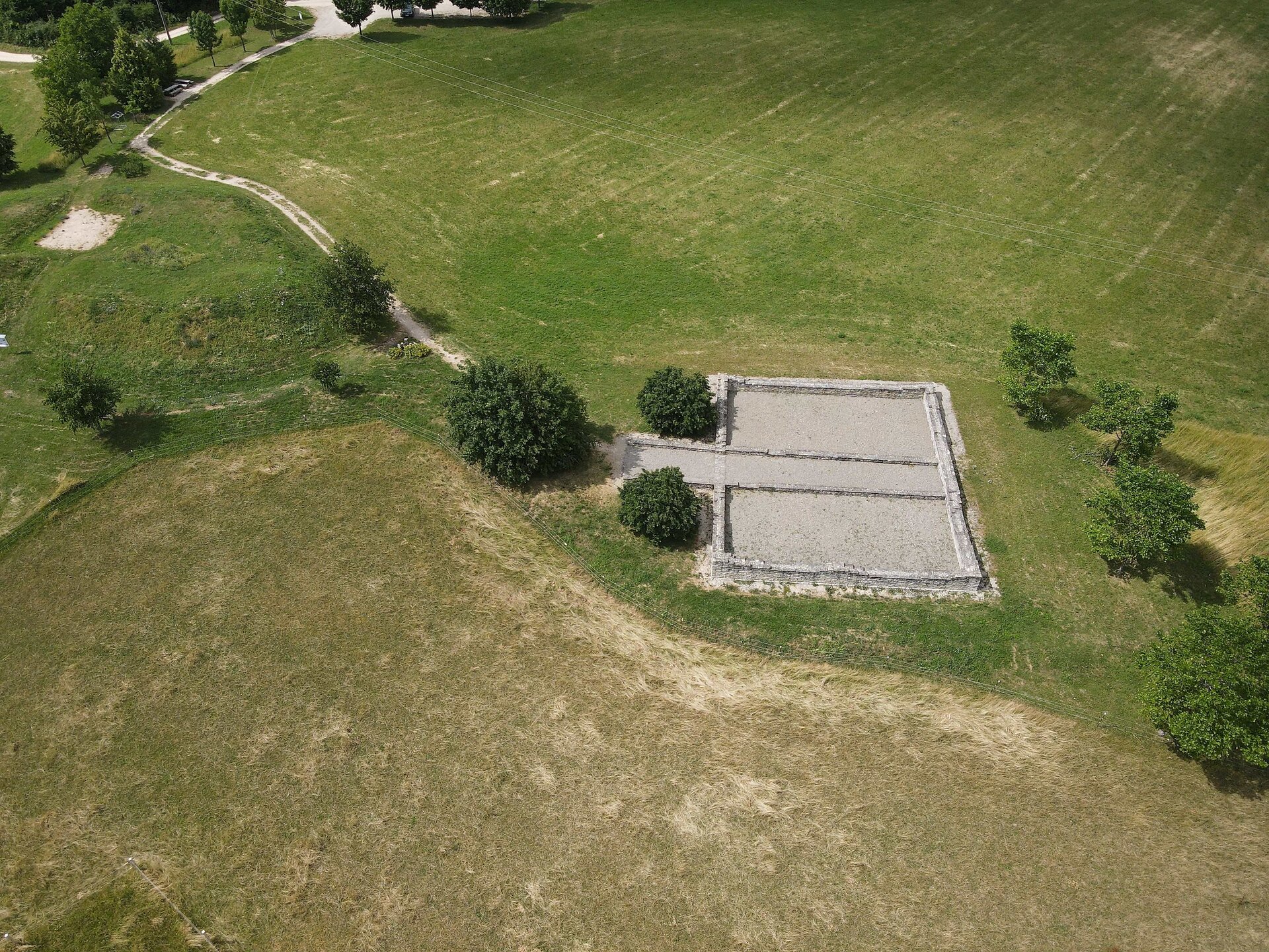
"Villa Rustica" Roman Estate in Eigeltingen
Lochmühle Dining Experience in Eigeltingen
Aach Spring—Germany’s largest spring in Aach
Steißlinger Lake in Steißlingen
Directions
The loop route offers starting points in the municipalities of Aach, Eigeltingen, Steißlingen, Orsingen-Nenzingen, and Volkertshausen, and can be ridden in any order you like.
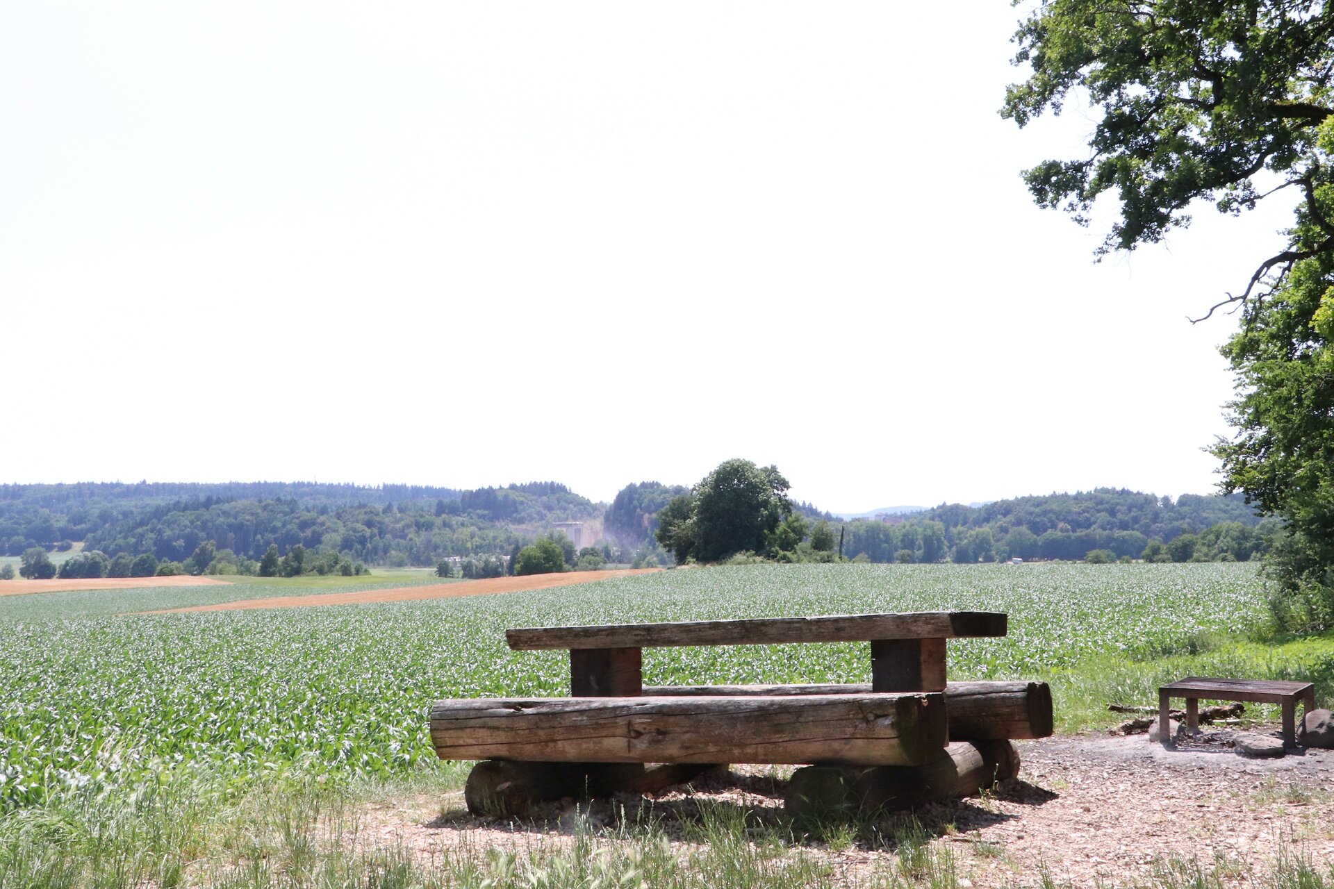
Coming from Steißlingen via the Kirnberg, you’ll reach the Orsingen-Nenzingen area. Passing the forest parking lot, you’ll reach the underpass beneath the A98 highway. At the foot of the Kirnberg, immediately after the underpass, you’ll come across the small Oberhofen Chapel, which is the last visible remnant of the former settlement “Oberorsingen.” Shortly before the village of Orsingen, you’ll pass County Road 6117 just before the first building (a lumberyard). This is followed by a ride through the idyllic landscape of the Krebsbach Valley, where you can also take a break at the forest barbecue area. After leaving the forest, the route leads to the “Herpele” hill, where it’s worth taking a detour to one of the most beautiful viewpoints in the area. From here, you can admire the beautiful Lake Constance in the distance. Following the route, you’ll reach Nenzingen on Brielstraße; at the end of this street, turn right onto Stockacher Straße. On Stockacher Straße, there are numerous opportunities to treat yourself to something from the local restaurants. You’ll cycle past the Nenzingen train station and then follow Bahnhofstraße and Braunenbergerstraße until you pass another neighborhood in the town. Here, keep to the right and leave Nenzingen heading toward the forest. Once you reach the forest, the route becomes a bit more challenging due to the incline. As you ride through the forest, the small, charming forest cabin with a barbecue area invites you to take a short break. As you leave the forest, you’ll have a great view of the Braunenberg. Now follow the path until you reach the farms in the “Dürrenast” area. After passing the crossroads, keep to the right and turn left at the next one. Here, you’ll leave the Orsingen-Nenzingen municipal boundary and cross into Eigeltingen near Dürrenast. The route takes you south of the Hardt forest district to the forest parking lot at the Mehlau. From there, turn right through the forest and head down to the Brielbach Bridge. After a short stretch on the K6114, the trail branches off to the west toward the Roman estate, which is one of a series of estates from the Roman Imperial period (1st to 3rd centuries) in our county. Here you have the opportunity to visit the excavations. From the parking lot there, you’ll also enjoy a beautiful view of the Hegauberge. Continue following the loop trail toward the “Bildstöckle” area, where a varied route on different surfaces awaits you. After you’ve finally crossed the L440, you’ll reach the well-known and popular destination Lochmühle. The local restaurants here are perfect for a short break. Passing Lochmühle, the trail now leads you up a short climb to Reischbühl. From here, you’ll catch a great view of the municipality’s landscape. Follow the route until you cross the K6119. Passing through the Vogelherd area, you’ll eventually reach Längenried as you ride along the edge of the forest. The loop trail now takes you into the territory of the town of Aach. Follow Vogstwiesweg toward the L194. Ride along the bike path for a short stretch before turning right again toward the forest. After climbing the Chorherrenweg, you’ll reach the Eggenhauptweg, which passes above the Alter Turm, an early medieval castle ruin. From here, you can enjoy the beautiful view of the town of Aach and even linger for a moment right by the Alter Turm. Continue westward past the Old Town, and you’ll reach the junction with Stadtstraße via the bike path along the L194, near the school sports field. If you’d like, you can also take a short detour across from the junction to St. Martin’s Chapel, which was rebuilt in 1984. Via Stadtstraße, you’ll reach the elementary school, the sports and community center, and a large parking lot, which serves as a good starting point for the route. Right after the “Alte Schule” (Old School) is the war memorial; it’s worth taking a short break here to enjoy the view over the Hegau region and the town of Aach. Afterward, the route heads downhill toward the source of the Aach—Germany’s largest spring! The Jägermühle inn, located right at the source of the Aach, is of course also an excellent spot for a short break. After crossing the L194 country road, the trail heads uphill along Ettenbergstraße through the residential area toward the east into the loop of the Ettenberg Forest. The trail then passes by the large greenhouses and the model airplane field and joins the local road heading toward Volkertshausen. With a spring in your step, you’ll come from Aach and cross the municipal boundary of the smallest municipality in the Constance district by area at the intersection near Bächlinger Äcker. Along Langensteiner Straße, past the Bächlinger Hof, you’ll have a direct view—on a clear day—of the Hohentwiel and the picturesque landscapes of the Hegau region, as well as the Alps on your left, which are covered in snow in the fall and spring. Once you arrive in the town of Volkertshausen, turn onto Grenzstraße at the first intersection and then immediately right onto Gartenstraße. At the end of the street, cross the K 6120 and follow Wiesenstraße until you reach the Aach again. Are you ready for a quick stop for refreshments? Volkertshausen’s restaurants offer several options. The Landgasthaus Sternen, with its home-style German cuisine, combines tradition with modernity in the town center. The Asia Restaurant Angkor, across from the Edeka, delights diners with delicious Cambodian and Chinese dishes. After a hearty meal, the trail leads you along the Aach, past the Wiesengrund sports complex, all the way to the A81 underpass. At this point, you’ll say goodbye not only to the beautiful Aach but also to Volkertshausen. After the A81 underpass, the loop trail leads you to the left toward Wiechs/Steißlingen. Coming from Volkertshausen, the route first runs along the A98 on a path that is sometimes narrow and grassy, and crosses a narrow bridge offering a magnificent view of the Weitenried Nature Reserve. Shortly before reaching a wooded area, turn right toward Steißlingen onto a wide dirt road that runs along the edge of the Weitenried to the K6121. There, take the county road and turn left into nearby Steißlingen. First, Lake Steißlinger greets you on the right and invites you to linger on the kiosk terrace (free admission for kiosk guests). This lake is designated a natural monument and is part of the Aacher Quelltopf karst region and the Danube seepage area. Next, ride along Beurener Straße to Hauptstraße (L223), keep left, and immediately turn onto Schulstraße. After about 70 meters, Schulstraße turns right between the town hall and the school; at the end of the street, the café “Eisgewaffelt” awaits with a variety of ice cream specialties. Here, turn left onto Lange Straße, passing the Landgasthaus Lamm (lunch served Mon, Tue, Sat 11:00 a.m.–2:00 p.m.), and continue straight through the entire village. Non-e-bike riders, take note: from here on, the road gets steep! Follow the local road toward Wahlwies until, just past the second curve, you turn left into the steep forested area of the Kirnberg. Once you reach the top of this wider, easily rideable forest trail, turn right—you’ve now reached the highest point of the entire MTB route. Shortly afterward, take a sharp left downhill to the barbecue area, which is already located within the Orsingen municipal boundaries.
Parking
Eigeltingen: Fairgrounds next to Lochmühle (Breitleweg/Hinterdorfstraße, 78253 Eigeltingen)
Aach: School/Gym Parking Lot (Schulstraße 5, 78267 Aach)
Volkertshausen: Wiesengrundhalle (Bärenloh, 78269 Volkertshausen)
Steißlingen: Seeblickhalle (Beurener Straße 34, 78256 Steißlingen)
Orsingen-Nenzingen: Rebberghalle Nenzingen (Im Grund 1, 78359 Orsingen-Nenzingen)
Public Transportation
Walk-in months
- April
- May
- June
- July
- August
- September
- October
Requirements
- Condition 3 detail.requirements.value
- Experience 4 detail.requirements.value
- Landscape 4 detail.requirements.value
- Difficulty 1 detail.requirements.value
Details
- Spring
- Summer
- Fall