


from Dornbirn
Dornbirner Höhenweg – Mountain bike loop from the Town Hall
Description
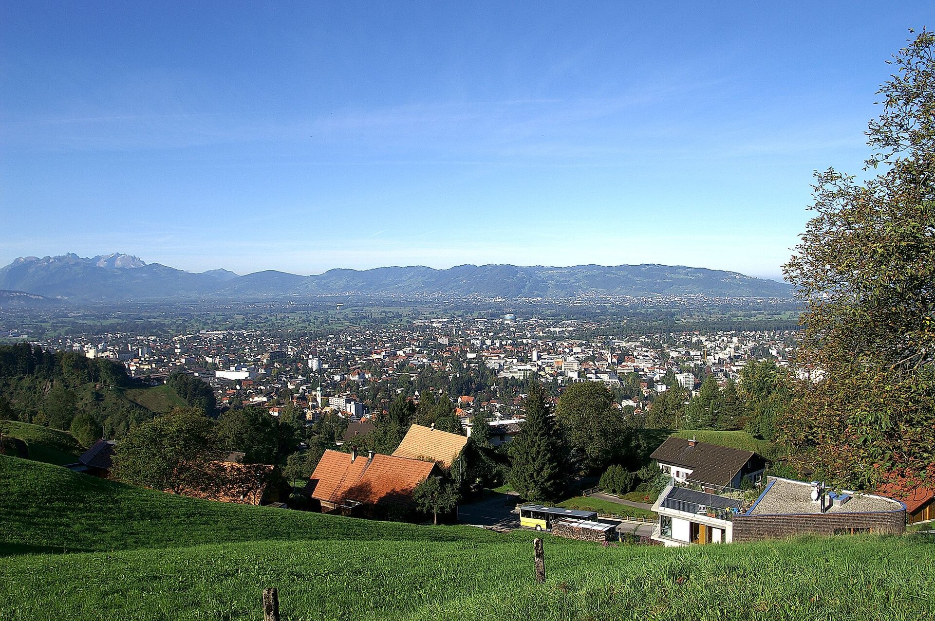
Starting at Dornbirn Town Hall, this approximately 13.3-kilometre mountain bike loop follows the Dornbirner Ache before climbing to the hillside hamlets above the town. Between Eschenau, Häfenberg, Watzenegg, Stüben and Fluh, wooded stretches, small settlements and views across the Rhine Valley provide plenty of variety.
The appeal of the Dornbirner Höhenweg lies in its changing character. An initially gentle ride towards the Karren cable car is followed by several short but demanding climbs, an undulating hillside section and a longer descent via Hohlen and Haselstauden. Tarmac roads give way at times to farm tracks, gravel and narrower paths.
This moderately difficult route is suitable for mountain bikers with good basic fitness and confident bike-handling skills. The steep sections and extended descent in particular require care. The loop starts and finishes at Dornbirn Town Hall, although it can also be joined at other suitable points along the route.

Short description
Starting at Dornbirn Town Hall, this approximately 13.3-kilometre mountain bike loop follows the Dornbirner Ache before climbing to the hillside hamlets above the town. Between Eschenau, Häfenberg, Watzenegg, Stüben and Fluh, wooded stretches, small settlements and views across the Rhine Valley provide plenty of variety.
The appeal of the Dornbirner Höhenweg lies in its changing character. An initially gentle ride towards the Karren cable car is followed by several short but demanding climbs, an undulating hillside section and a longer descent via Hohlen and Haselstauden. Tarmac roads give way at times to farm tracks, gravel and narrower paths.
This moderately difficult route is suitable for mountain bikers with good basic fitness and confident bike-handling skills. The steep sections and extended descent in particular require care. The loop starts and finishes at Dornbirn Town Hall, although it can also be joined at other suitable points along the route.
Detailed description
The mountain bike loop begins at the Town Hall in the centre of Dornbirn. The opening stretch leads through the town towards the Dornbirner Ache. Following the river, the surroundings soon become greener: flowing water, riverside scenery and views of wooded slopes provide a gentle introduction before the route reaches the lower station of the Karren cable car. Here, the relatively level warm-up gives way to the first sustained climb.
Above the lower station, the route gains height quickly on a narrow tarmac road. The ascent towards Eschenau is fairly continuous at first. After just a few kilometres, the town lies noticeably further below, while meadows, scattered houses and the hillside landscape come to the fore. At Eschenau, the steady climb becomes a more varied ride, with brief downhill sections offering a chance to recover.
The Dornbirner Höhenweg then passes through the area above Steinebach towards Häfenberg. Surfaced stretches alternate with unsurfaced tracks, and a few steep ramps call for a strong effort. The groups of houses at Häfenberg reveal another side of Dornbirn: a historic rural settlement has survived here among meadows and wooded hillsides. The route then climbs noticeably again towards Watzenegg.
Watzenegg is already well above the valley floor. In clear weather, the open hillside sections offer views over Dornbirn and the Rhine Valley. The route continues through the hillside hamlets towards Bantling and Stüben. Small settlements, meadows and patches of woodland follow one another; rather than one continuous climb, this part of the circuit is characterised by short ascents and descents. These changes give the ride much of its appeal, but also reward sensible pacing.
Between Stüben and Fluh, the route reaches its highest section at around 720 metres above sea level. From more open parts of the hillside, there are views across Dornbirn's rooftops, far into the Rhine Valley and, on a clear day, towards Lake Constance. Shadier woodland sections lead through the rolling landscape above the town. The hamlet of Fluh marks the transition to the final, predominantly downhill part of the circuit.
A longer descent takes the route through the Hohlen area towards Haselstauden, with some distinctly steep sections. Streets, houses and everyday town life gradually replace the quieter hillside scenery. Controlled speed is particularly important on the upper part of the descent; further down, the terrain becomes considerably flatter. The route continues through Dornbirn to the Town Hall, where the loop ends after approximately 13.3 kilometres. Riders wishing to start elsewhere on the circuit can use another suitable and permitted access point.
Getting there
The route starts and finishes at the Town Hall on Rathausplatz in the centre of Dornbirn.
By public transport
Bus stop at the start/finish: Dornbirn Rathaus, directly by the starting point.
Train station at the start/finish: Dornbirn Bahnhof; the railway station is not directly at the start, but the Town Hall can be reached from there by bus or bicycle.
Travel by train to Dornbirn Bahnhof and continue by bus to the Dornbirn Rathaus stop. Bus service 161 is one of the services connecting the railway station with the Town Hall. Check bicycle carriage arrangements in advance if needed.
Journey planner: vmobil.at
By car
Approach Dornbirn via the main access roads and follow signs towards the town centre and Rathausplatz. Pay attention to the local traffic arrangements and signs for the underground car park.
Parking
Stadtgarage (Rathaus underground car park), Rathausplatz 1, 6850 Dornbirn. This public underground car park is immediately beside the starting point. The parking and usage conditions displayed on site apply.
Equipment
A well-maintained mountain bike with tyres offering good grip and reliable brakes is recommended, together with a cycling helmet and clothing suitable for the weather. Shoes with good grip are useful on the steeper and partly unsurfaced sections. Carry enough water, a small snack, sun and rain protection, and a charged mobile phone. A spare inner tube, pump and compact repair kit are useful for minor mechanical problems.
Safety information
Several short climbs are distinctly steep, and narrow or unsurfaced sections along the hillside route may require extra attention. The longer descent from the higher ground near Fluh is steep in places. Adjust your speed to visibility, bends, the riding surface and your ability. Take particular care on wet ground, fallen leaves or loose gravel.
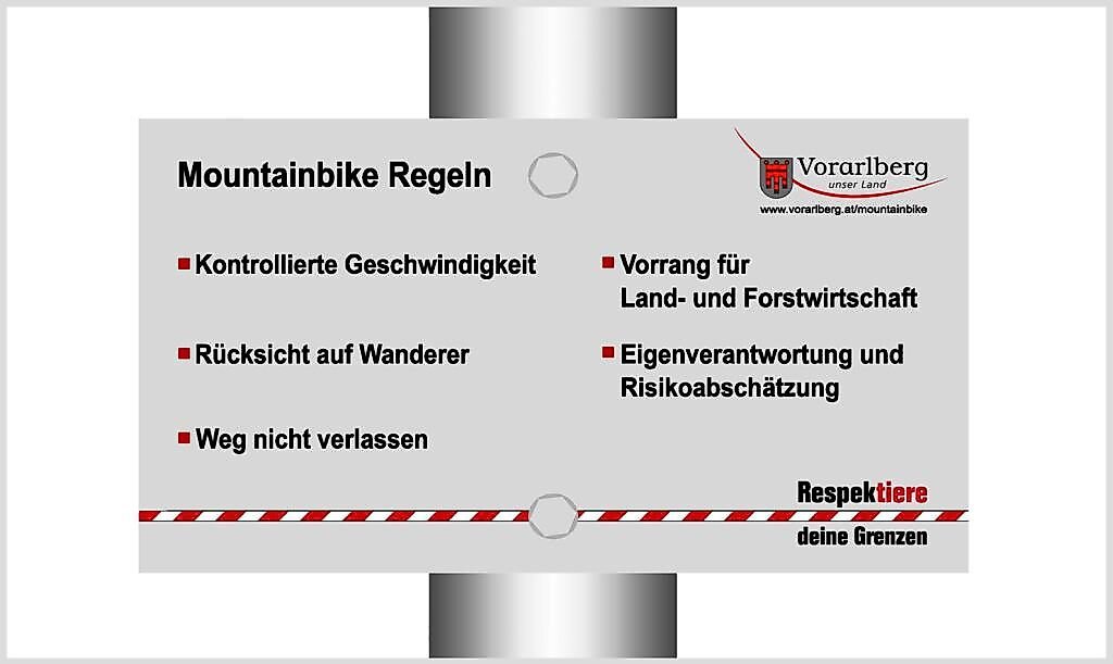
Expect other road users in the town and at road crossings. Give way to people on foot on shared paths and be mindful of agricultural and forestry vehicles. Use only routes open to cycling, obey closures and signs, and avoid shortcuts through woods or meadows. Check the weather and current route conditions before setting off.
Additional information
Over a relatively short distance, the Dornbirner Höhenweg brings together three distinct settings: the town centre around the Town Hall, the riverside landscape of the Dornbirner Ache and the higher, partly rural hillside hamlets. The lower station of the Karren cable car is a notable landmark near the beginning of the ride. The circuit does not climb to the Karren upper station.
There is an interesting glimpse of local architectural and settlement history around Häfenberg, where historic farmhouses dating from the late 18th and early 19th centuries survive. The more open hillside stretches offer opportunities to pause and enjoy the views. Places to eat and drink can be found in central Dornbirn before or after the ride; check current opening times in advance.
Dry days without snow or ice are best suited to this route. Despite its manageable distance, the steep sections and descent make it a sporting mountain bike ride rather than a leisurely family outing.
Requirements
- Condition 3 detail.requirements.value
- Experience 4 detail.requirements.value
- Landscape 5 detail.requirements.value
- Technique 2 detail.requirements.value
Details
Season
- Spring
- Summer
- Fall
Location
- End
-
City Hall
Rathausplatz 2
6850 Dornbirn, Austria Read more


Publisher / Copyright: Bodensee-Vorarlberg Tourismus GmbH – (c) Bodensee-Vorarlberg Tourismus GmbH / Rudolf Mayerhofer